Published on
Author
The ocean is… big.
You only have to go a few miles offshore to lose sight of land. It’s at that point that no matter how large of a vessel you’re sailing on, you realize the vastness of Earth’s oceans and your relative smallness. Oceans cover more than 70% of the planet’s surface. They are integral to regulating carbon in the atmosphere, the primary source of sustenance for millions of people, and generate most of the weather we experience on land. Yet we know more about the surface of Mars than we do about the depths of the Pacific.
In the early days of Antarctic exploration, it was a six-month voyage from Europe to the Southern Ocean. Today, it takes a cargo ship about three weeks to travel from China to the USA, out of sight of land for all but several hours. A 60-foot trimaran called Mighty Merloe set the 2017 record of four days and change for a transpacific crossing from Los Angeles to Honolulu, albeit traveling at speeds that make it difficult to eat a bowl of oatmeal, let alone collect scientific data.
Sailing is a romantic endeavor on a warm evening, the sky a panoply of color as the sun meets the horizon, the gentle lap of the water against the hull. But the ocean is an unforgiving place and “champagne sailing” is not guaranteed. Even in the most tropical of climates, violent storms barrel across the blue, carrying with them rain, lightning, and powerful winds that churn up massive breaking waves.

The National Oceanic and Atmospheric Administration (NOAA) operates 16 research vessels that contribute much of what we know about the world’s oceans and the creatures that live there. A handful of additional ships are operated by universities, research institutions, and science agencies in Europe, Asia, and Australia. But despite the immense value of ship-based observation, there are many challenges—weather, logistics, and cost—and limited resources to support them. Each ship costs between $80 million to $150 million to build and up to $100,000 per day to operate.
“It’s fuel, consumables, and I don’t even want to tell you what our satellite bill is for data,” said Andreas Marouchos, a research group leader with Australia’s Commonwealth Scientific and Industrial Research Organisation (CSIRO).
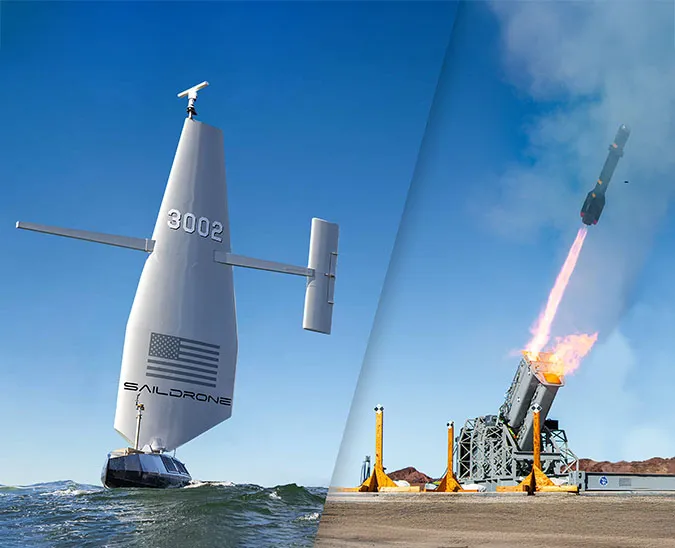
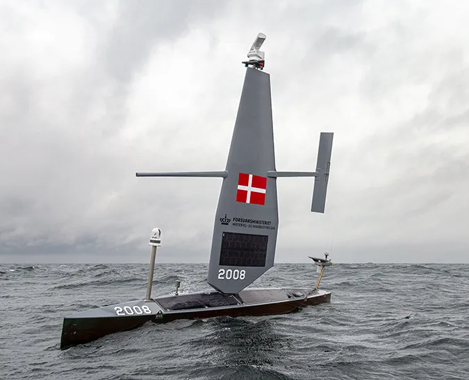
Saildrone unmanned surface vehicles (USVs) augment conventional observation platforms—ships, satellites, buoys, and floats—on a mission-as-a-service basis, providing highly accurate data collection to government agencies and commercial companies. We manage each mission from start to finish so that scientists can focus on their research.
Saildrones carry a suite of 20 science sensors to collect data above and below the sea surface, modernizing essential marine biology tasks like fish stock assessments and improving the quality and regularity of valuable meteorological and oceanographic measurements. Because they are wind and solar powered, saildrones don’t require any fuel and don’t disturb the delicate ecosystems they study. They are exponentially less expensive to operate, significantly smaller and therefore capable of surveying areas too shallow for ships to enter, and designed for up to 12-month missions in the harshest ocean conditions—no scopolamine patches required.
Past and potential mission objectives include bathymetric mapping, traffic monitoring, detecting oil seeps and spills, and collecting metocean data. Saildrones have already sailed more than 250,000 nautical miles, studying the relationship between northern fur seals and their primary food source, walleye pollock, in the Bering Sea to understand the fur seals’ sharp decline; leveraging collected data to develop a more robust weather forecast; and leading scientists to the White Shark Café, an inhospitable area of the Pacific Ocean integral to the migratory habits of great white sharks.

“This is one of the largest migrations, one of the largest stories, and we don’t know enough about it or about what goes on in the ocean overall,” said Stanford marine biologist Barbara Block of the Saildrone White Shark Café Ecosystem Survey. “I think this type of technology will help us fill in the gaps at a crucial time for our planet.”
Saildrone is building a fleet of 1,000 USVs, to cover the planet at a six-by-six-degree resolution (one saildrone per 360 nautical miles squared) providing round the clock in situ observations about the world’s oceans and lowering the cost of data acquisition by order of magnitude. Saildrone USVs will serve an integral role in a near-real-time planetary-scale monitoring system we call, “The Quantified Planet.”
Millions of people around the world are adversely affected by floods, droughts, storms, fires, and rapid changes to the marine ecosystem. The time is now to take full advantage of cutting-edge technology to improve our understanding of previously understudied planetary systems that affect humanity. After all, we can’t fix what we can’t measure, and we can’t prepare for what we don’t know.
Read more at Bloomberg: This Armada of Saildrones Could Conquer the Ocean and Inc: The Most Exciting Drones Aren’t in the Air—They’re in the Ocean.


