Published on
Author
The atmosphere and the ocean are constantly interacting. Solar energy passing through the atmosphere warms the planet. The oceans absorb the majority of the heat, which is transported around the planet via ocean currents; the currents are, in turn, largely wind driven. Oceans are cooled through latent heat of evaporation and sensible heat fluxes, that is, by releasing heat into the atmosphere. Warm, moist air is buoyant, and as it rises, it releases heat. As the air cools, it condenses forming clouds, which affect the amount of sunlight that reaches the surface and therefore the amount of solar energy that can be absorbed by the ocean. Air-sea heat flux is the scientific term for the absorption and release of heat between the ocean and the atmosphere.
In the paper, “Air-Sea Fluxes with a Focus on Heat and Momentum,” Meghan F. Cronin, Chelle L. Gentemann, et al. discuss a need for a global, integrated observational strategy to measure air-sea fluxes that meets accuracy targets equal or better than OceanSITES reference station moorings and research vessels. The paper calls for the establishment, by 2030, of a global array including autonomous vehicles, buoys, and research vessels for in situ observation of surface flux variables; approximately 1,000 individual platforms are needed for global coverage if each vehicle patrols roughly one million square kilometers, as well as an expanded OceanSITES network in some two dozen key regions.
OceanSITES is a relatively young network of some 22 deep-water reference stations that provide real-time data access, high-resolution measurements, and multiyear time scales for dozens of variables. The design of a global air-sea flux monitoring system will require regional adjustments and densities based on ocean conditions, flux patterns, and operational realities.
The anticipated outcome of the proposed 2030 Air-Sea Flux Observing System is improved prediction of long-term weather and climate influenced by the oceans and quantification of ocean carbon uptake and resulting ocean acidification.
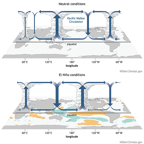
There are several types of air-sea fluxes in addition to heat: water (evaporation and precipitation), momentum (wind stress), and gases, e.g. carbon dioxide (CO2). Air-sea heat and water fluxes have the most direct influence on global weather. El Niño is one well-known example of how air-sea heat and water fluxes influence weather. During an El Niño event, surface atmospheric heating and towering clouds shift across the equatorial Pacific, leading to atypical temperature and precipitation patterns around the globe. Normally wet areas like Indonesia experience drought, and normally drier areas like the Americas experience higher-than-average precipitation.

As temperatures rise on Earth, increased air-sea fluxes of moisture intensify hurricanes and monsoons in the tropics and affect weather patterns causing droughts and floods over land. Early awareness of changes to flux patterns can have a significant socio-economic benefit, however, air-sea fluxes have significant uncertainties, and there are inherent challenges to collecting accurate data due to technology limitations and harsh ocean conditions.
More than eight essential ocean and climate variables (EOVs, ECVs) are required to compute various air-sea fluxes including sea and air temperature, atmospheric pressure, wind speed and direction, humidity, and solar radiation (longwave and shortwave). This data has historically been collected piecemeal via a diverse assortment of moored buoys, floats, and satellites. Each platform collects a different limited set of variables. Satellite sensors, for example, are unable to measure sea surface humidity or air temperature with the accuracy required to resolve air-sea heat fluxes because of the intervening atmosphere.
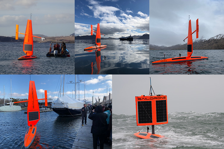
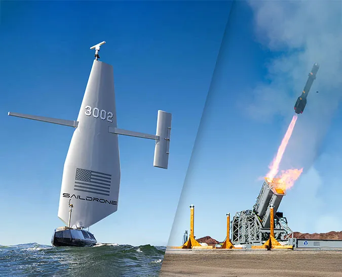
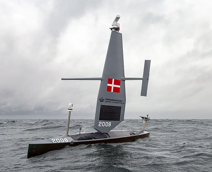
Saildrone autonomous surface vehicles (ASVs) are autonomous ocean-going vehicles equipped with a payload of science sensors to collect in-situ measurements of the EOVs and ECVs for resolving air-sea fluxes. The standard Saildrone sensor suite measures more than a dozen variables above and below the sea surface, including temperature (air and sea), humidity, pressure, radiation, dissolved oxygen, chlorophyll-a, and salinity, as well as wind speed and direction and wave height and period. Optionally, Saildrones can also be equipped with an Acoustic Doppler Current Profiler (ADCP) to measure ocean current vectors at multiple depths, a NOAA PMEL ASVCO2 sensor to measure the partial pressure of carbon dioxide, or an echo sounder for animal tracking and fisheries surveys.
Powered by wind for forward propulsion and solar energy to run onboard sensors and navigational instruments, saildrones are completely silent and therefore do not disturb the ecosystem they are observing. Saildrone USVs have completed long-term missions in the most remote areas of the ocean—the Arctic, Tropical Pacific, and the first autonomous circumnavigation of the Southern Ocean—demonstrating the vehicle’s viability as an ocean observation platform in a diverse range of conditions.

Saildrone data collected on minutely or hourly intervals is transmitted in real time via the Iridium satellite network for immediate access by research partners. High-resolution data (1 second or greater frequency) is downloaded from the vehicle once it is retrieved. Data is available to the research community via one of several public data portals.
“With speeds of up to 2.5 knots for wave-propulsion ASV and 7 knots for wind-propulsion ASV (depending upon wind and ocean conditions), and endurances of 6 months to a year, ASVs can cover thousands of nautical miles. This gives ASVs the capability to either sample in a station-keeping mode, like moored buoys, to create a fixed time series, or in repeat section-mode, or adaptive sampling mode, to do surveys like a research vessel (RV).” (Cronin, Gentemann, et al. 2019)
The successful establishment of a global air-sea flux observing system will require cooperation on an international scale between public research institutions and private technology. Saildrone is committed to the public-private partnership model, having established a robust partnership framework with the scientific community to develop and refine the Saildrone sensor suite and manage the resulting data.
For the past five years, Saildrone has worked with scientists and researchers at the National Oceanic and Atmospheric Administration (NOAA)’s Pacific Marine Environmental Laboratory (PMEL) to rigorously test the capabilities of the vehicle platform. Most recently, the 2019 ATL2MED mission leverages the scientific expertise of 12 European research institutions, as well as the generous financial support of PEAK6, a private technology and investment firm, to launch the first Atlantic to Mediterranean mission, which includes an eddy survey and CO2 measurements and cross-calibrations of European Research Infrastructure (RI) sites. A fleet of five saildrones is part of the 2020 EUREC4A/ATOMIC mission, a massive international collaboration to study ocean-atmosphere interactions in the Western Atlantic.
Ocean processes drive large-scale planetary patterns affecting weather and climate, food supply, shipping, and socio-economic issues. Understanding these processes is critical to sustainably managing resources, planning and preparing for natural disasters, and adapting to changes taking place in the environment. The time is now to take full advantage of cutting-edge technology that improves our understanding of planetary systems that affect humanity.
Resources
Meghan F. Cronin, Chelle L. Gentemann, et al., “Air-Sea Fluxes With a Focus on Heat and Momentum,”Frontiers in Marine Science, July 31, 2019.


