
Thank you! Your submission has been received!
Oops! Something went wrong while submitting the form.

 Missions
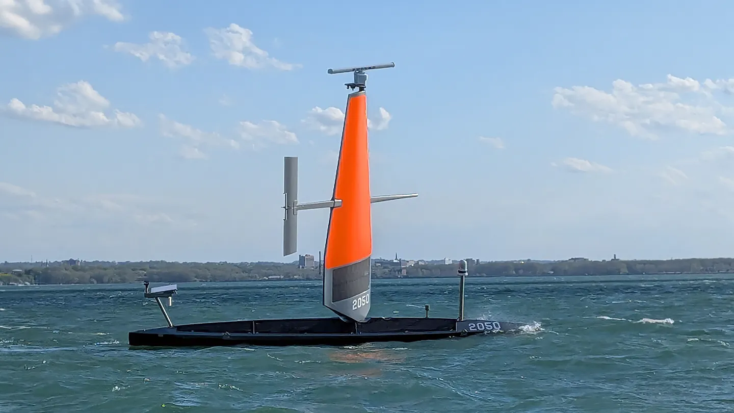
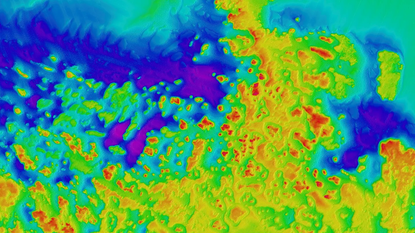
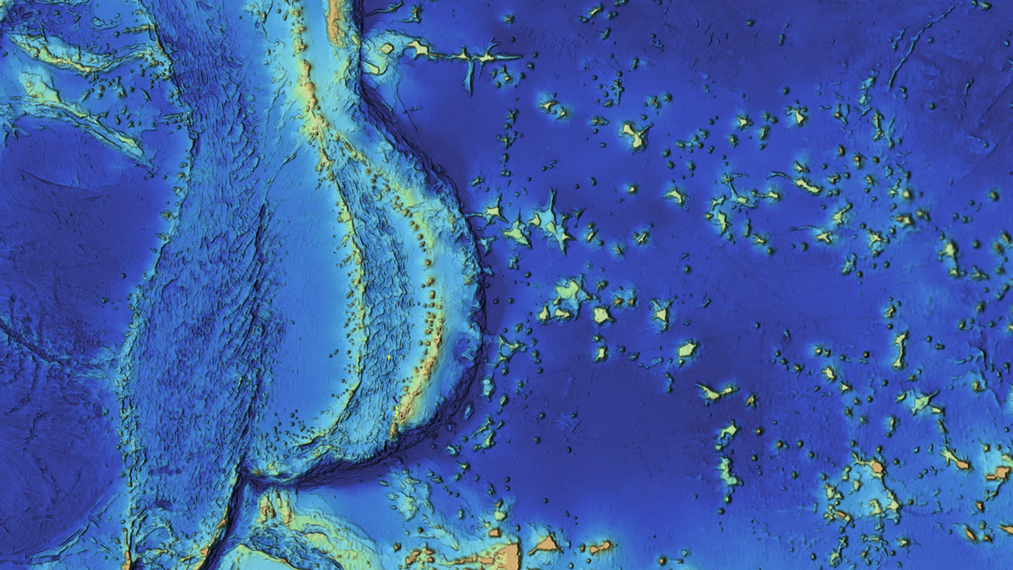
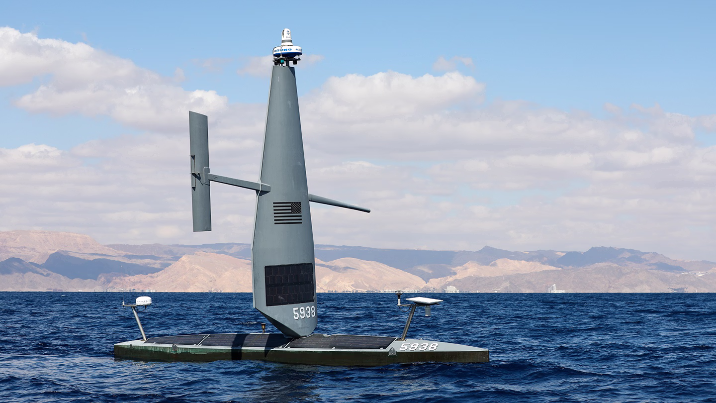
Mapping the Cayman Islands’ EEZ: Lessons Learned From a First-of-Its-Kind Autonomous Survey
Saildrone mapped 90,000 square kilometers of seafloor, supporting fisheries management, offshore energy planning, resource exploration, strengthening maritime security, and protecting fragile habitats.
Missions


Never Miss an Update
Stay informed with the latest research findings and updates.
Thank you! Your submission has been received!
Oops! Something went wrong while submitting the form.