Published on
Author
Two Saildrone unmanned surface vehicles (USVs) that have been crisscrossing the Tropical Atlantic Ocean off the northern coast of South America since late January have completed their mission. The saildrones have been collecting data to improve the understanding of air-sea interactions on behalf of the National Atmospheric and Oceanic Administration (NOAA)’s Atlantic Tradewind Ocean-Atmosphere Mesoscale Interaction Campaign (ATOMIC).
ATOMIC is the US counterpart to the European multinational EUREC4A (Elucidating the role of clouds-circulation coupling in climate) field observation in the western tropical Atlantic. ATOMIC and EUREC4A began with a 40-day intensive observation period (IOP) in late January involving four research vessels from three countries, four airplanes, and a fleet of autonomous surface and subsurface vehicles, including five saildrones. The goal was to understand air-sea interactions with a focus on mesoscale ocean eddies and their influences on atmospheric shallow convection and formation of shallow cumulus clouds.

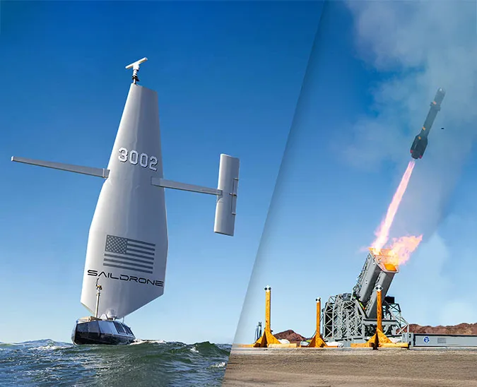
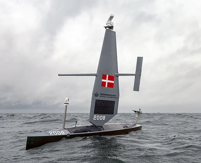
Powered by 100% renewable energy (wind and solar), the Saildrone USVs are faster than most other unmanned platforms—they sail at a speed of 2–3 knots, an average human walking pace, depending on wind and current conditions—and have longer range and endurance. The saildrones also offer high-quality measurements of the essential ocean and atmospheric variables critical for the air-sea interaction process (Zhang et al. 2019).
“The speed of the saildrones was critical for autonomous observation during the intensive observation period (IOP, January – February 2020) to survey across and follow moving eddies in this region. Their long endurance also allowed the saildrones to make continuous measurements after the IOP of ATOMIC and EUREC4A,” said Dongxiao Zhang of the University of Washington’s Cooperative Institute for Climate, Ocean, and Ecosystem Studies (CICOES) working with NOAA’s Pacific Marine Environmental Laboratory (PMEL) and one of the two principal investigators of the ATOMIC project.
During the initial observation period in Jan./Feb. 2020, one saildrone contracted by the NOAA/CPO Climate Variability and Predictability Program was dedicated to the ocean eddy corridor between the Barbados Cloud Observatory (BCO) and the moored Northwest Tropical Atlantic Station (NTAS) buoy in Easterlies Alley. The second NOAA saildrone and three NASA-funded saildrones formed a cluster to better resolve eddies in the North Brazil Current (NBC) Ring corridor southeast of BCO.
“During the IOP, the saildrone fleet was coordinated with the participating research vessels, aircraft, and other autonomous observing platforms. The unique combination of observing platforms enabled the simultaneous observation of the lower-atmosphere and the upper-ocean with an unprecedented spatio-temporal multi-scale sampling,” said Zhang.
The three NASA saildrones completed the IOP and returned to Barbados in early March to be shipped back to San Francisco just days before travel restrictions due to the COVID-19 pandemic went into effect. The two saildrones contracted by the NOAA continued their mission in the Tropical Atlantic through April, May, and June.
The five vehicles working in the Tropical Atlantic sailed a combined ~35,000 nautical miles (40,280 miles or 64,820 kilometers) between January and July—that’s almost two times around the Earth at the equator!
A saildrone collects data in the Tropical Atlantic as part of the combined EUREC4A and ATOMIC campaigns. Courtesy Dr. Sabrina Speich aboard the RV Atlante.
The primary objectives of the extended observation period were to sufficiently sample the air-sea fluxes, including all components of air-sea heat fluxes and wind stresses and cloud images across different types of ocean eddies in different seasons (boreal winter, spring, and summer); better understand the air-sea interaction processes on both eddy and regional scales; and provide a benchmark data set for validation of satellite observations and high-resolution coupled climate and weather forecast models.
Throughout the mission, the saildrones repeatedly demonstrated their capacity for sailing in precise formations, patterns around stationary marks, and station-keeping in challenging conditions—shifting winds and strong currents. The areas of survey included NOAA buoys, ocean eddies, and across frontal regions.
Despite COVID-19 travel restrictions, Saildrone has continued to operate several missions in the Atlantic and Pacific, including the recently launched Alaska pollock survey for NOAA Fisheries and Saildrone’s first bathymetry mission in the Arctic in collaboration with TerraSond on behalf of NOAA’s National Ocean Service (NOS), as well as the Atlantic to Mediterranean mission, which will soon wrap up in Trieste, Italy.
Read more: Studying Tropical Air-Sea Interactions in the Atlantic
Resources
“Atlantic Tradewind Ocean-Atmosphere Mesoscale Interaction Campaign,” Physical Science Laboratory, NOAA, accessed July 15, 2020
Dongxiao Zhang, Meghan F. Cronin, et al., “Comparing Air-Sea Flux Measurements from a New Unmanned Surface Vehicle and Proven Platforms During the Spurs-2 Field Campaign,” Oceanography, Vol. 32, No. 2 (2019)
“NOAA Launches Major Field Campaign to Improve Weather and Climate Prediction,” NOAA Research News, January 7, 2020